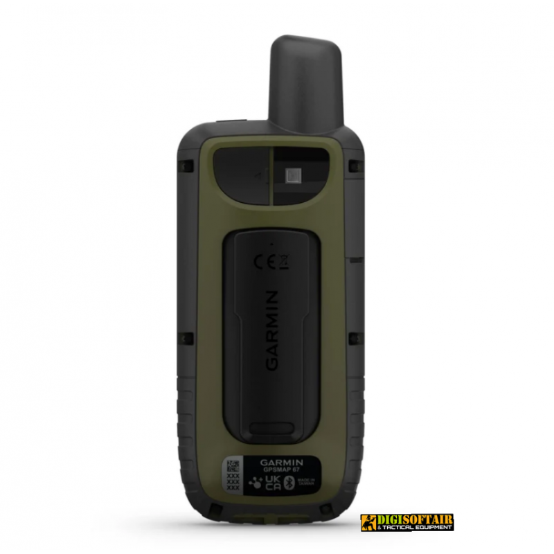
EXPLORE WITHOUT LIMITS
Make the most of your time outdoors. Long battery life and multiband technology for increased accuracy, plus preloaded TopoActive maps and access to satellite imagery.
Discover new routes and destinations with GPS Map 67 from Garmin. This portable, water-resistant device is packed with advanced features like pre-loaded topo maps, a 3-axis electronic compass, a barometric altimeter, and high-sensitivity satellite technology.
Thanks to its intuitive interface, the eTrex 67 allows you to easily plan routes and navigate safely and accurately, even in hostile and unfamiliar environments. Plus, with the ability to use microSD cards, you can store all the data and information you need for your outdoor adventures.
Garmin's Map 67 GPS is an indispensable tool for outdoor enthusiasts, from hikers to cyclists, who want to explore the world with confidence and precision.MULTI-BAND GNSS SUPPORT
Access multiple global navigation satellite systems (GPS, GLONASS, Galileo and QZSS). You can access more frequencies sent by satellite systems for more accurate location tracking in areas where GNSS signals are reflected, weak, or more generally cannot penetrate.
SENSORS ABC
Navigate every trail with ABC sensors, which include an altimeter for elevation data, a barometer for pressure monitoring, and a 3-axis electronic compass.
SATELLITE IMAGES
Download high-resolution photo-realistic maps directly to your device via Wi-Fi® technology. Easily find routes, choose locations, find parking, create waypoints and so much more.
DESIGNED FOR ADVENTURE
This portable device meets military standards MIL-STD-810, guaranteeing resistance to extreme temperatures, shocks and water, and is also compatible with night vision goggles.
LED TORCH
The GPSMAP 67 series saves on the weight of your equipment with a built-in LED flashlight that can be used for signaling for help.
GEOCACHING
Download automatic cache updates from Geocaching Live, including descriptions, logs, and hints. When connected via Wi-Fi technology or the Garmin Explore™ smartphone app, each search will be uploaded to your Geocaching.com profile.
ACTIVE WEATHER
Once connected to the Garmin Explore smartphone app, you can access real-time forecast information, so you'll always be up to date on weather trends.
GARMIN EXPLORE™ APP
Plan, review and sync waypoints, routes and tracks using the Garmin Explore app and website. You can also review completed tasks while you're still out.
BATTERY LIFE
The internal rechargeable Li-ion battery provides a battery life of up to 180 hours in GPS mode and up to 840 hours in expedition mode.
Dimensions 6.2 x 16.3 x 3.5cm (2.5″ x 6.4″ x 1.4″)
Screen size, WxH 3.8 x 6.3cm (1.5″W x 2.5″H ); 7.6cm diagonal (3″)
Screen resolution, WxH 240 x 400 pixels
Screen type transflective color TFT
Weight 230 g with batteries
IPX7 waterproof rating
Battery Li-ion, rechargeable
Battery Life Up to 180 hours in default mode
Up to 840 hours in expedition mode
MIL-STD-810 Yes (thermal, shock, water); only bare unit
USB-C interface
Memory/History 16GB (User space varies based on maps included)
Maps and memory
Cartography preloaded Yes (TopoActive Europe; roads passable)
Additional cartography
Worldwide basemap
Automatic route calculation (with precise turn-by-turn directions)
Map segments 15,000
BirdsEye Yes (directly on device)
Includes detailed hydrographic information (coastlines, river/lake banks, marshes and perennial and seasonal streams)
Includes searchable points of interest (parks, campgrounds, scenic spots and picnic areas)
Allows you to view national, state and local parks, forests and nature preserves
Storage capacity and power supply Yes (max 32GB microSD™ card)
Memorable positions 10,000
Routes 250, 200 checkpoints per route
250 tracks
Track log 20,000 points, 250 gpx tracks saved, 300 fitness activities saved
Activity Yes
Memorable routes 250, 250 points per route; automatic route calculation 50 points
sensors
High sensitivity GPS receiver
GPS
GLONASS
Galileo
QZSS
BeiDou
IRNSS
Barometric altimeter
Compass Yes (tilt-compensated, 3-axis)
GPS compass (on the go)
Multiband frequency
Daily Smart Features
Connect IQ™ (downloadable watch faces, data fields, widgets and apps)
Smart notifications on the mobile device
VIRB™ remote control
Compatible with Garmin Connect™ Mobile
Active weather
Security and tracking features
LiveTrack
Functions for outdoor activities
Point to point navigation
TracBack®
Area calculation
Calendar for hunting and fishing
Ephemeris
XERO™ locations
Suitable for geocaching Yes (Geocache Live)
Compatibleand with custom maps Yes (500 custom map tiles)
Image viewer
LED med flash
inReach® functionality
Compatible with InReach®
External applications
Compatible with the Garmin Explore ™ app
Compatible with the Garmin Explore website
Connections
Wireless Connectivity Yes (Wi-Fi®, Bluetooth®, ANT+®)


